3D Views of Pilot Knob State Nature Preserve
Powell County, Kentucky
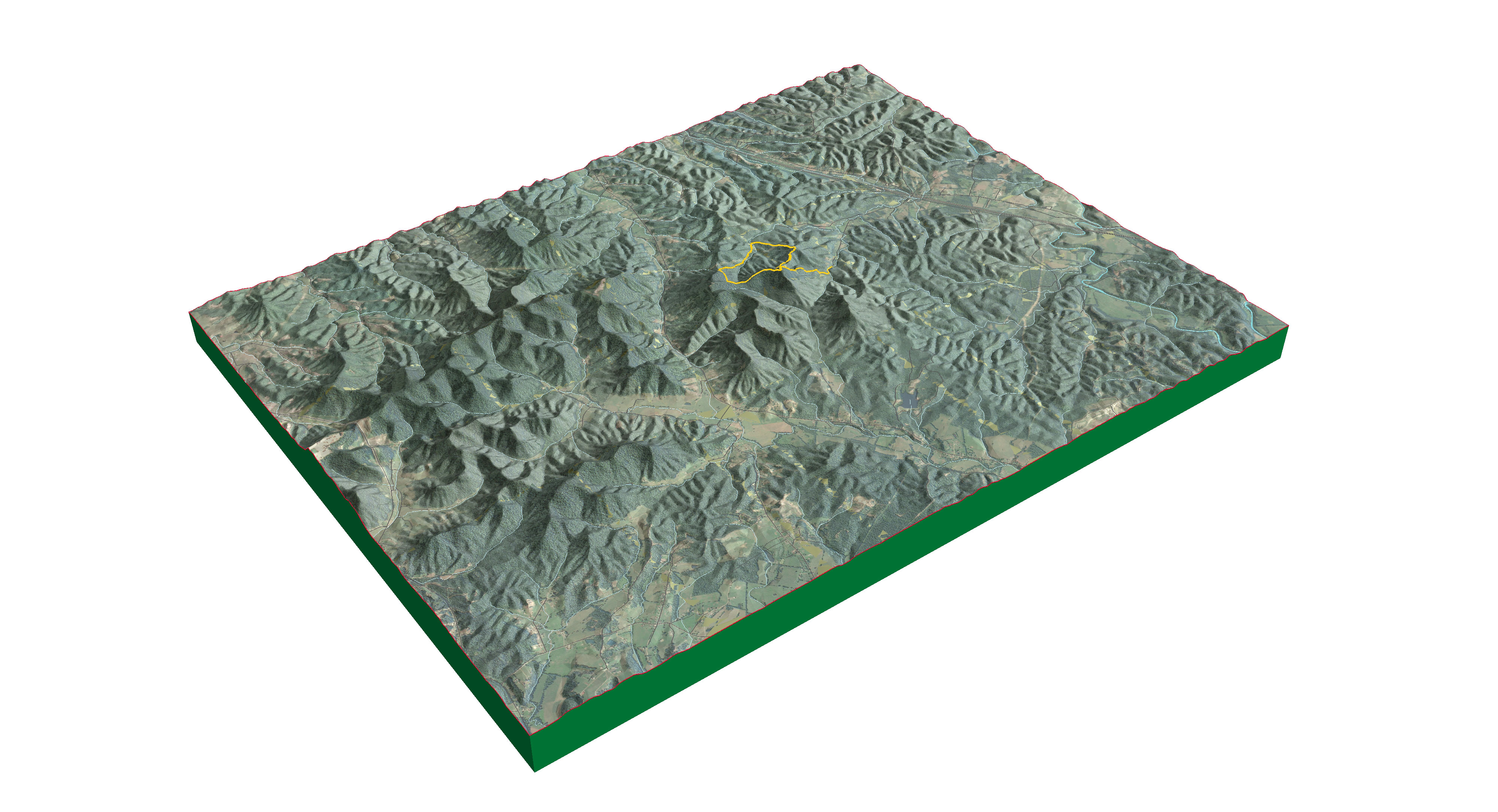
A distant view of the Pilot Knob SNP area
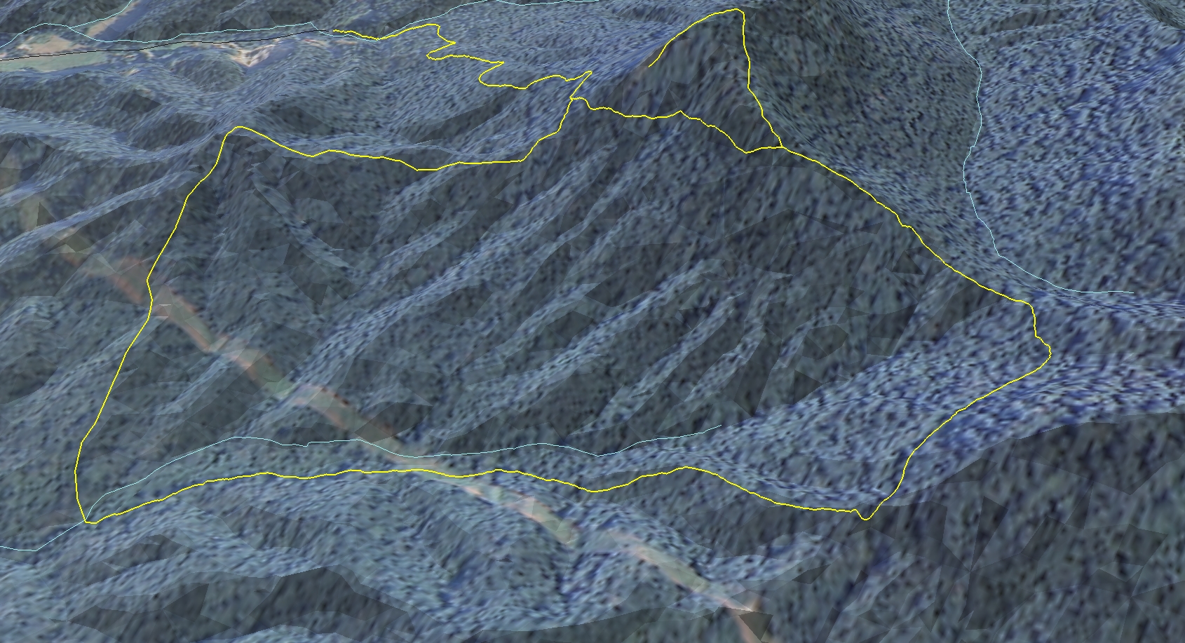
A view of the Pilot Knob SNP Overlook Trail
 Elevation profile of the Overlook Trail
Trail statistics: The Overlook Trail is 1.22 miles in length with an average slope of of approximately 9°. The highest slope is 40°. The elevation relief is approximately 650 feet.
A rendered animation of the Pilot Knob area
An interactive map showing the Pilot Knob and Sage Point trails, their distance in miles and change in elevation.
Page created by Amelia Baylon, November 16, 2016, for NRE 355, an introduction to GIS analysis at the University of Kentucky CAFE Natural Resources and Environmental Sciences program. Our class visited the nature preserve on September 21, 2016 and used mobile devices to collect GPS data for the existing trail network. We mapped approximately 3.2 miles of trail and used ArcGIS to create a 2D map and 3D visualization of the nature preserve..


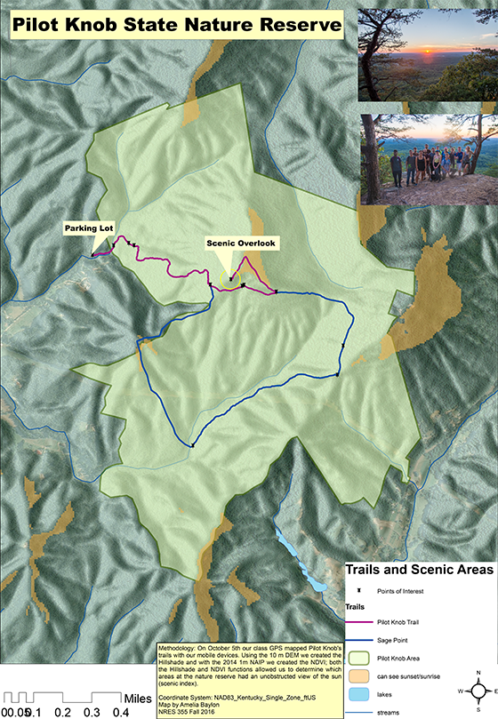
Geospatial PDFShowing scenic index and hiking trails
The methodology for creating the Scenic Index is explained in the image above, click on map for details.
Page created by Amelia Baylon on November 28, 2016, for NRE 355, an introduction to GIS analysis at the University of Kentucky C.A.F.E. Natural Resources and Environmental Science Program.