
Let's get this party rolling! | 409 journals
Lab 1: Pedestrian V. Car Crash Analysis
Louisville Analysis | Lexington Analysis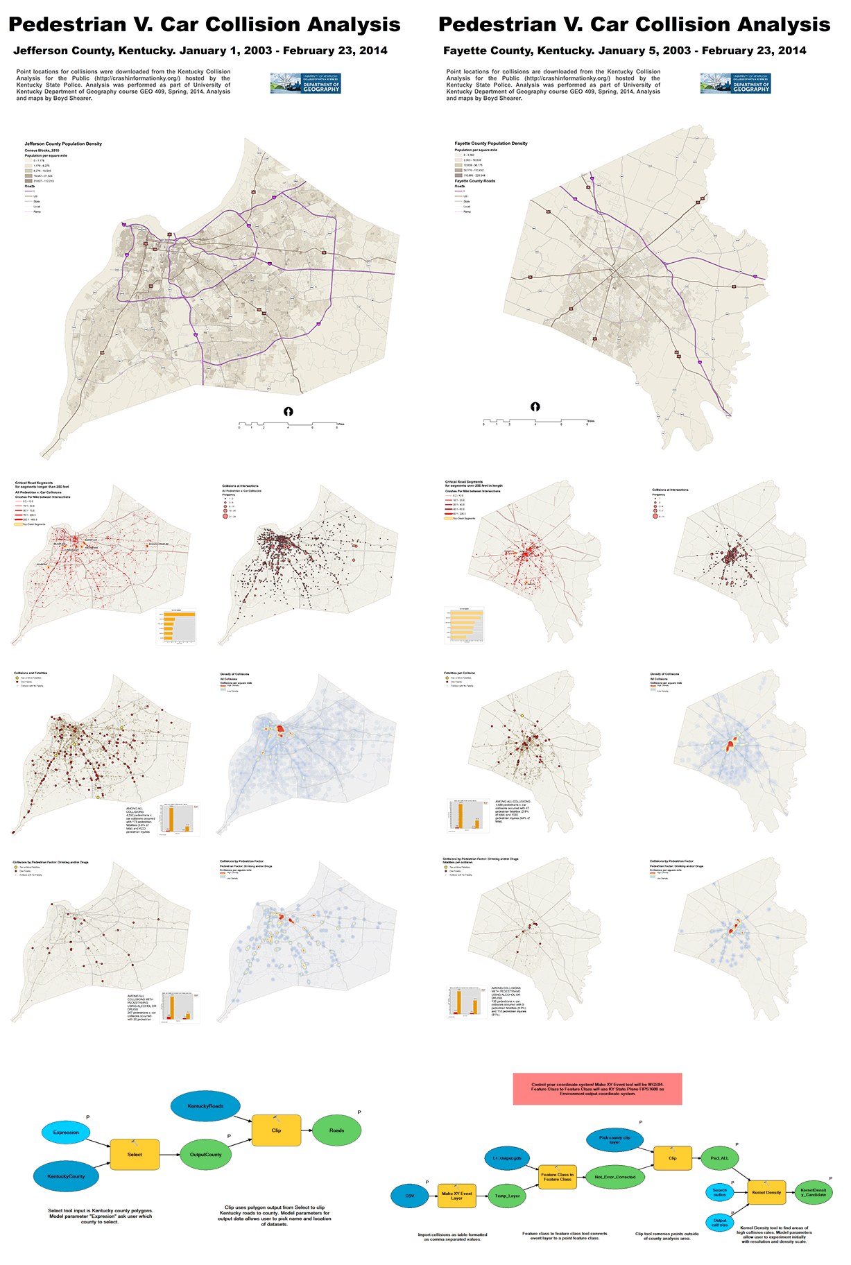
Lab 2: Lexington Walkability Analysis

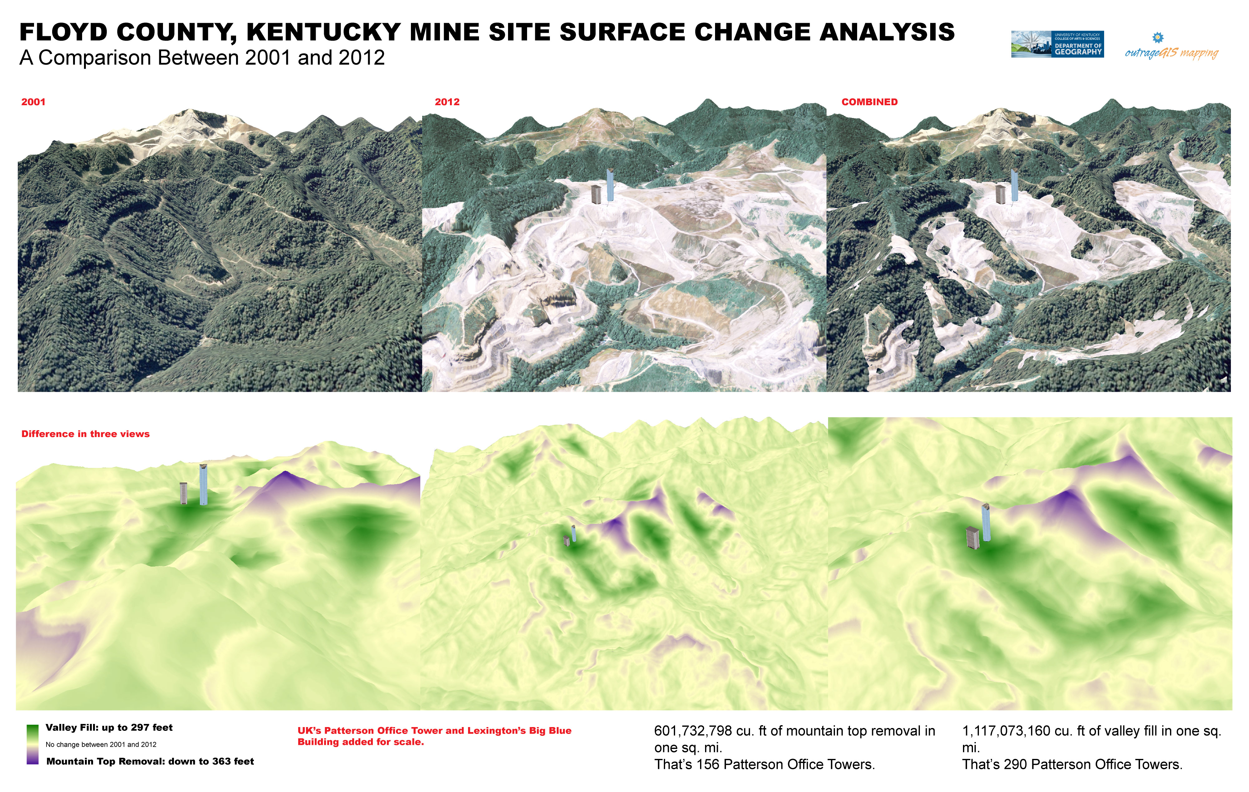
Lab 3: 3D Analysis and Visualization
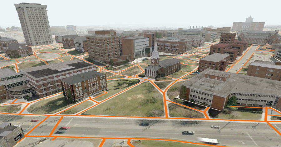
Final Project: Modeling and Visualizing UK Campus Pedestrian Paths
Challenge 1: Build this web page to present future challenges and labs.
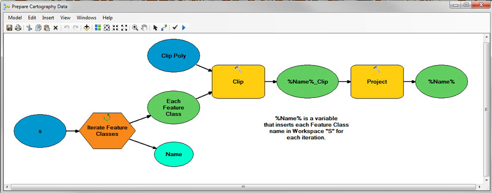
Challenge 2: Build a model to import spatial data to desired extent
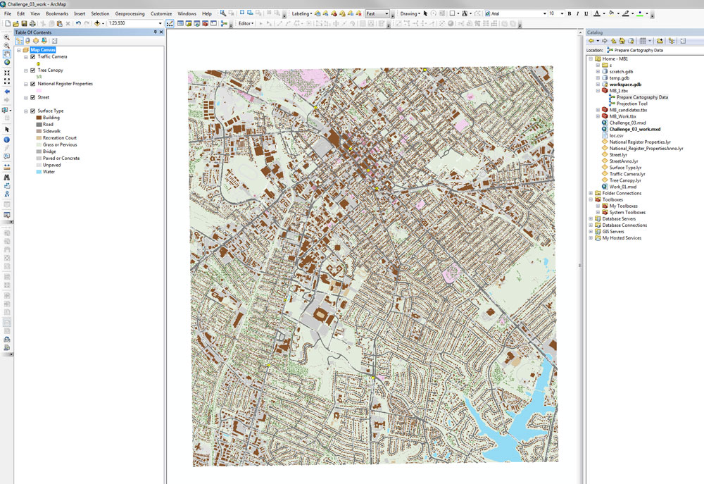
Challenge 3: Make a GeoPDF that can be used on a mobile device
Lexington's Historic Places and 2007 Surface Type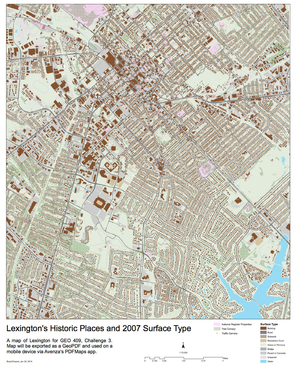
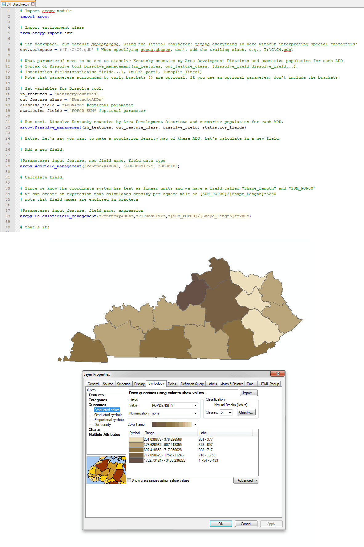
Challenge 4: Write a stand-alone script that dissolves features by attribute
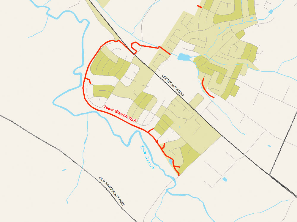
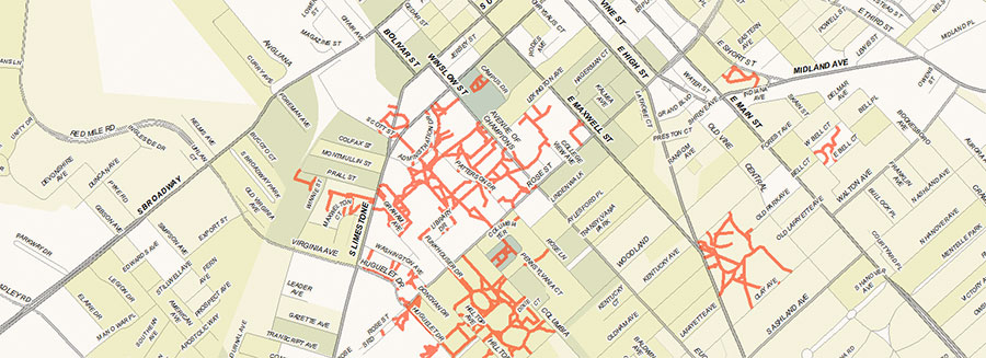
Challenge 5: Make a map that shows existing shared use trails in Lexington
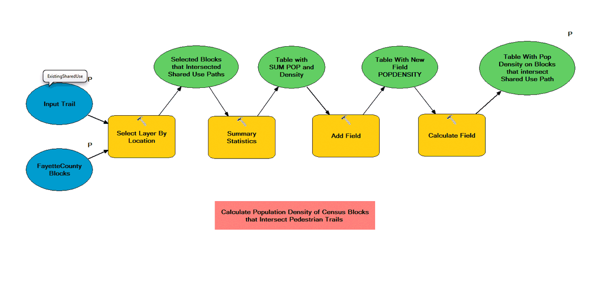
Challenge 6: Build a model that calculates population density along trails
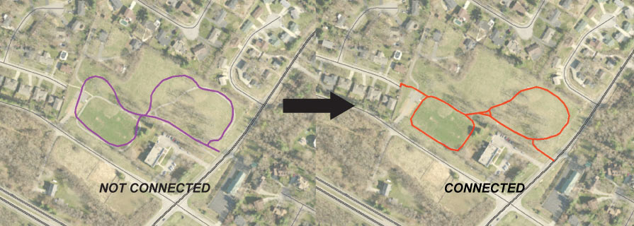
Challenge 7: Create topologically connected trails for your zone
Challenge 8: Advance labeling techniques, create an annotation layer for your zone
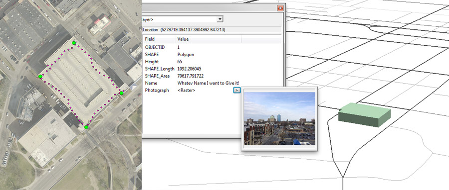
Challenge 9: GPS and 3D model parking towers
Challenge 10: Existing paved path and sidewalk pedshed slippy map and image compression techniques (Full version)