3D Views of Pilot Knob State Nature Preserve
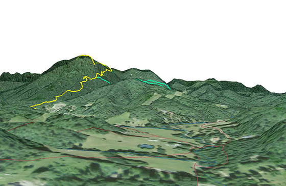
A distant view of the Pilot Knob
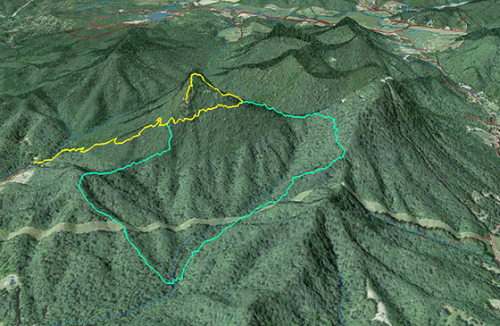
A view of the Pilot Knob SNP Overlook Trail (Yellow) and the Sage Trail (Green)
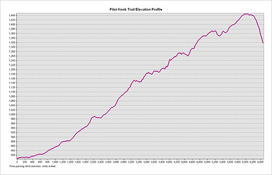
Elevation profile of the Overlook Trail
Trail statistics: The Overlook Trail is 1.2 miles in length with an average slope of of approximately 9°. The highest slope is 40°. The elevation relief is approximately 650 feet.
A rendered animation of the Pilot Knob area
This webpage created by Christopher Knabel, with the help of Boyd Shearer, November 14, 2016, for NRE 355, an introduction to GIS analysis at the University of Kentucky CAFE Natural Resources and Environmental Sciences program. I mapped the nature preserve on September 21, 2016 by using my mobile device application AvenzaPDF Maps. I collected GPS data for the existing trail network. I then mapped approximately 3.2 miles of trail and used ArcGIS to create a 2D map and 3D visualization of the nature preserve.

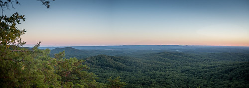

The above photos are accredited to Boyd Shearer and were taken ontop of the Pilot Knob Outlook
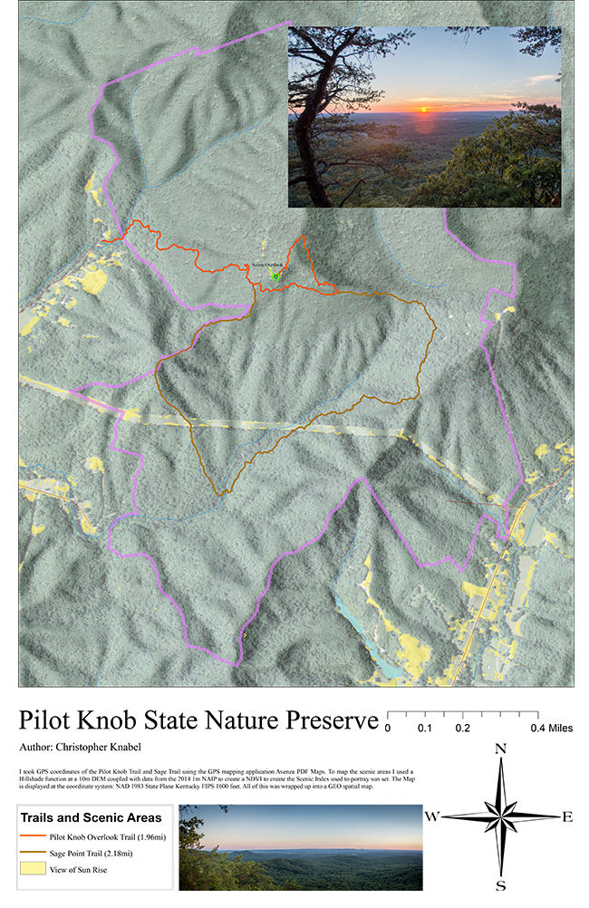
Geospatial PDF showing scenic index and hiking trails
My methodology for creating the Scenic Index was to use ArcGIS's Raster Calculator function to find areas that are not covered in tree canopy and are illuminated by a setting and/or rising sun using the sun's position for September 21. The index uses three layers as input in Raster Calculator; an NDVI raster from 2016 NAIP aerial photography and two Hillshade rasters from 10-meter DEM showing areas of illumination during an equinox sunrise and sunset.
Find the other students' pages here: http://sweb.uky.edu/~blshea1/nre355/pksnp/
This is a navigateable map made on Carto that will an overhead view of Pilot Knob.