My 3D Views of Pilot Knob State Nature Preserve


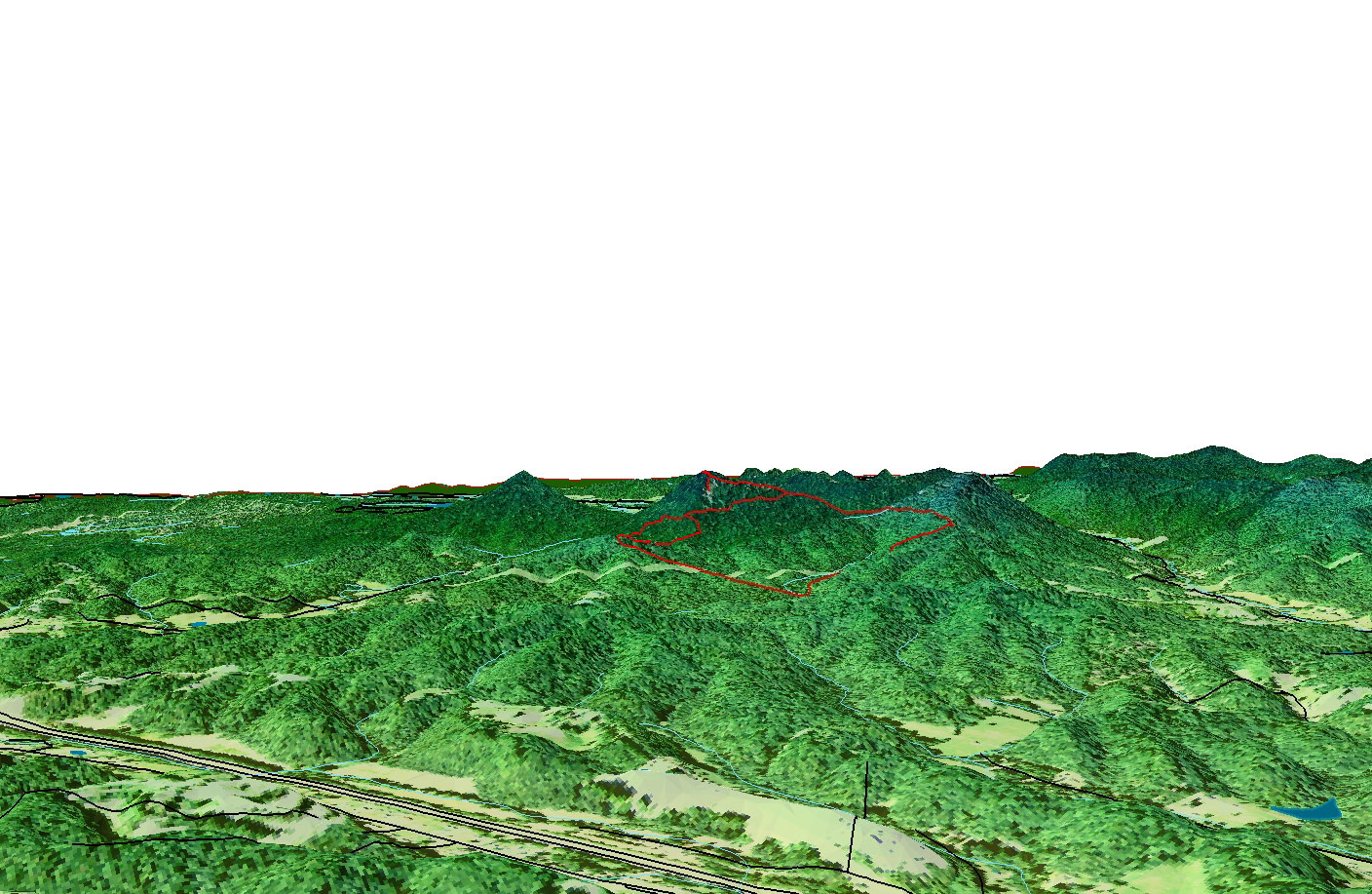
Picture 1: "Pilot Knob From A Far"

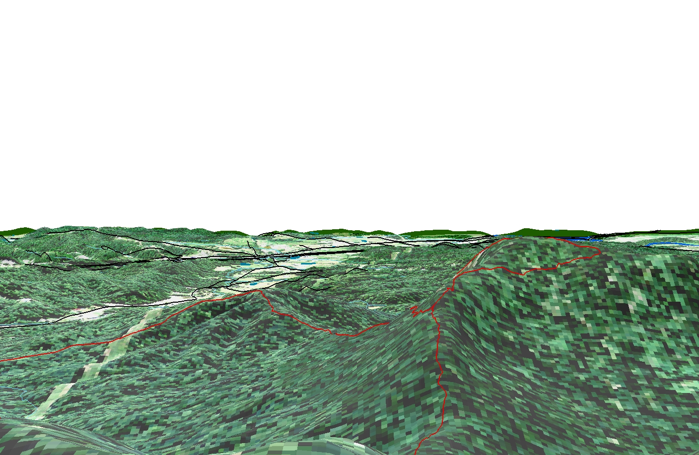
Picture 2: "From Top To Bottom View"


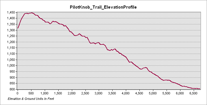
Elevation profile of the Trail
Trail statistics: The Pilot Knob Overlook Trail is 1.22 miles in length with an average slope of of approximately 9 °. The highest slope is 40°. The elevation relief is approximately 650 feet.

Both of these videos above are rendered animation of the Pilot Knob area. The video on the bottom is colored for elevation relief.

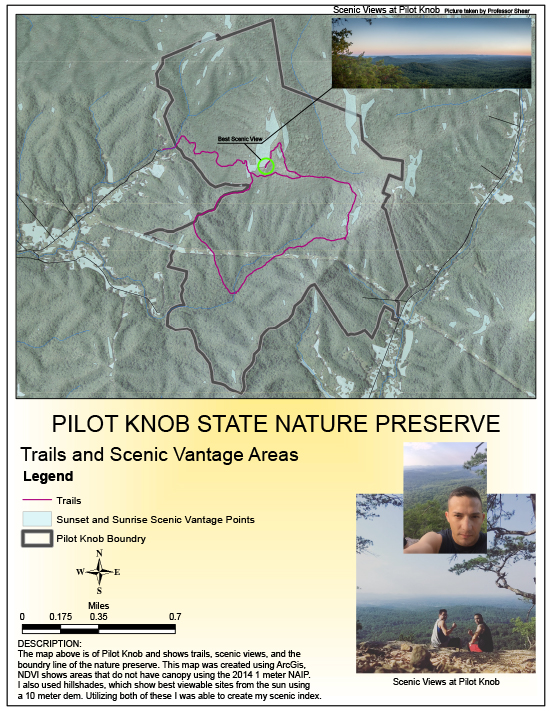
Interactive Map of Pilot Knob


Mapping Project Information of Pilot Knob I visited the nature preserve in Clark County on September 21, 2016 and used my cell phone to collect GPS data for the existing trail network at Pilot Knob. I mapped approximately 3.2 miles of trail and used ArcGIS to create a 2D map and 3D visualization of the nature preserve.

Geospatial PDF Showing scenic index and hiking trails Page created by Felipe Trejo, November 14, 2016, for NRE 355, This class gave me an introduction to GIS analysis at the University of Kentucky CAFE Natural Resources and Environmental Sciences program.