Views of Pilot Knob State Nature Preserve

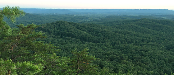
Distant view of the Pilot Knob SNP Area
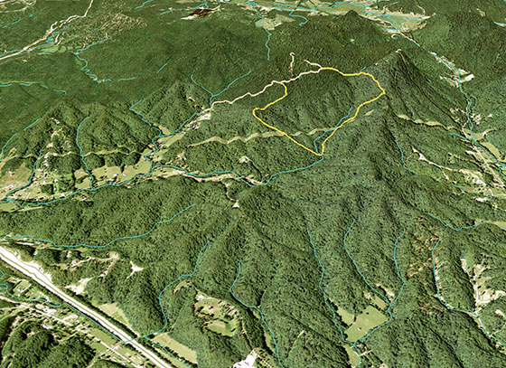
Birdseye view of the Overlook and Sage Point Trails
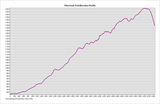
Elevation profile of the Overlook Trail
Trail statistics: The Overlook Trail is 1.22 miles in length with an average slope of of approximately 9°. The highest slope is 40°. The elevation relief is approximately 650 feet.
A rendered animation of the view from the Pilot Knob overlook
Page created by Hannah Moore. 28 November, 2016. NRE 355 (an introduction to GIS analysis at the University of Kentucky, Natural Resources and Environmental Sciences program). GPS data was collected using mobile devices to map the existing trail network of the nature preserve (21 September, 2016). ArcGIS was used to create a 2D map and 3D visualization of the nature preserve and its approximate 3.2 miles of hiking trails.

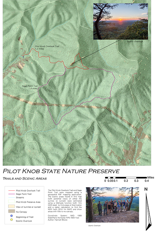
Geospatial PDF -Scenic Index, hiking trails
The scenic index was created using a hillshade function (with 10m DEM data) to find areas of illumination and an ArcGIS raster calculation to find the NDVI (with 2014 1m NAIP) and show areas with little to no canopy. By combining these two functions, we were able to highlight areas with potential views of the sunrise and sunset.