Views and Maps of Pilot Knob State Nature Preserve
Located in Powell County, Kentucky
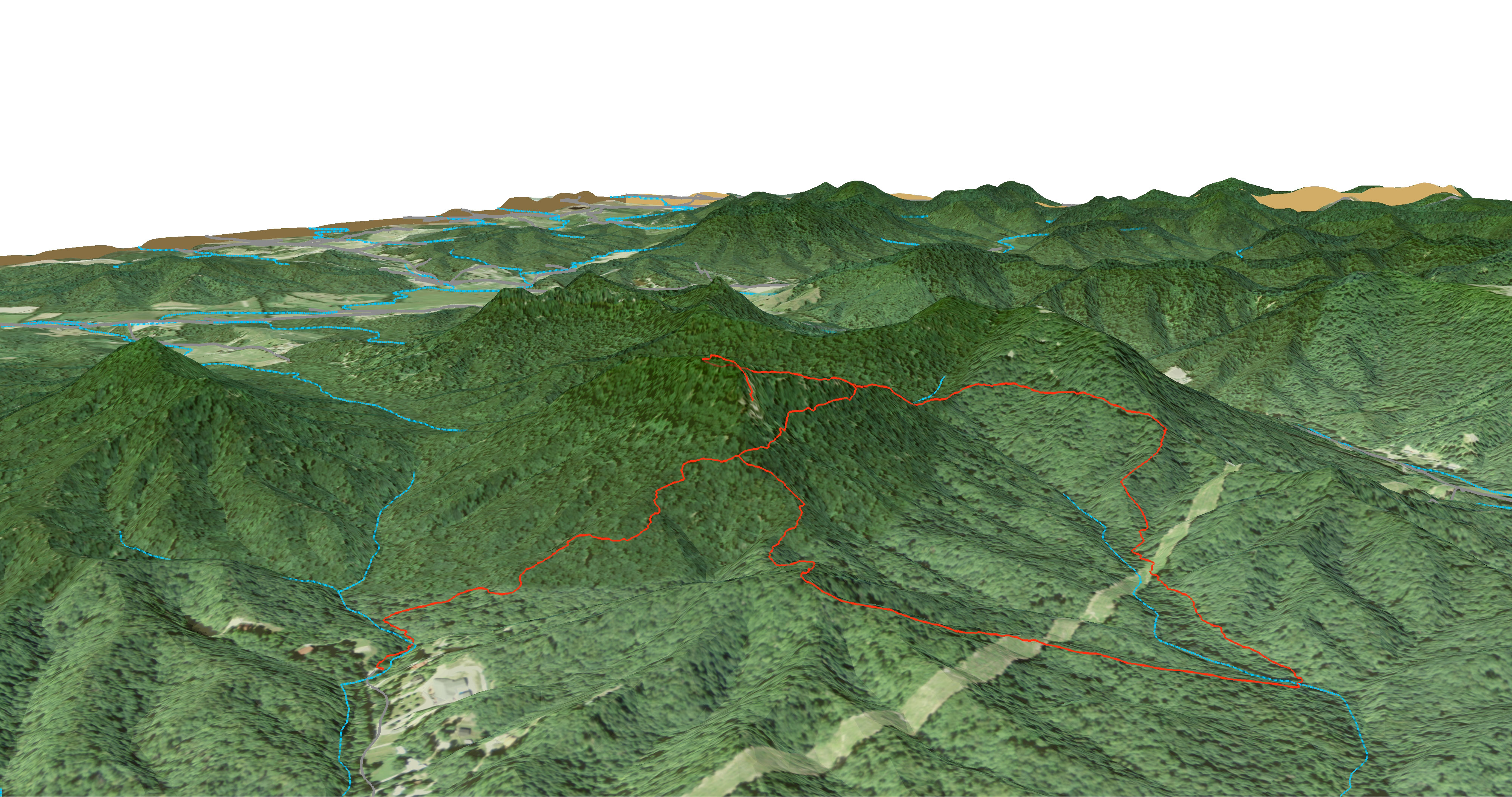
The Pilot Knob SNP Overlook Trail
A Birds Eye View of the Pilot Knob SNP Area
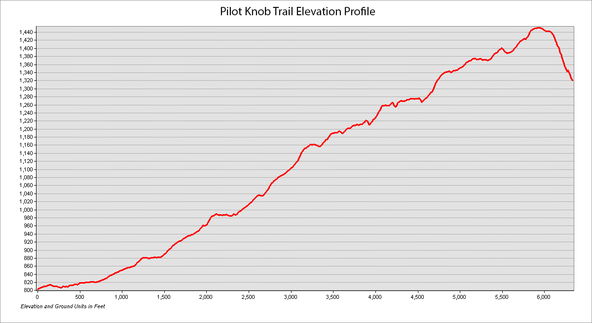
Elevation profile:
The Overlook Trail is 1.2 miles in length with an average slope of approximately 9.27°. The highest slope is 39.56°. The elevation relief is approximately 648 feet.
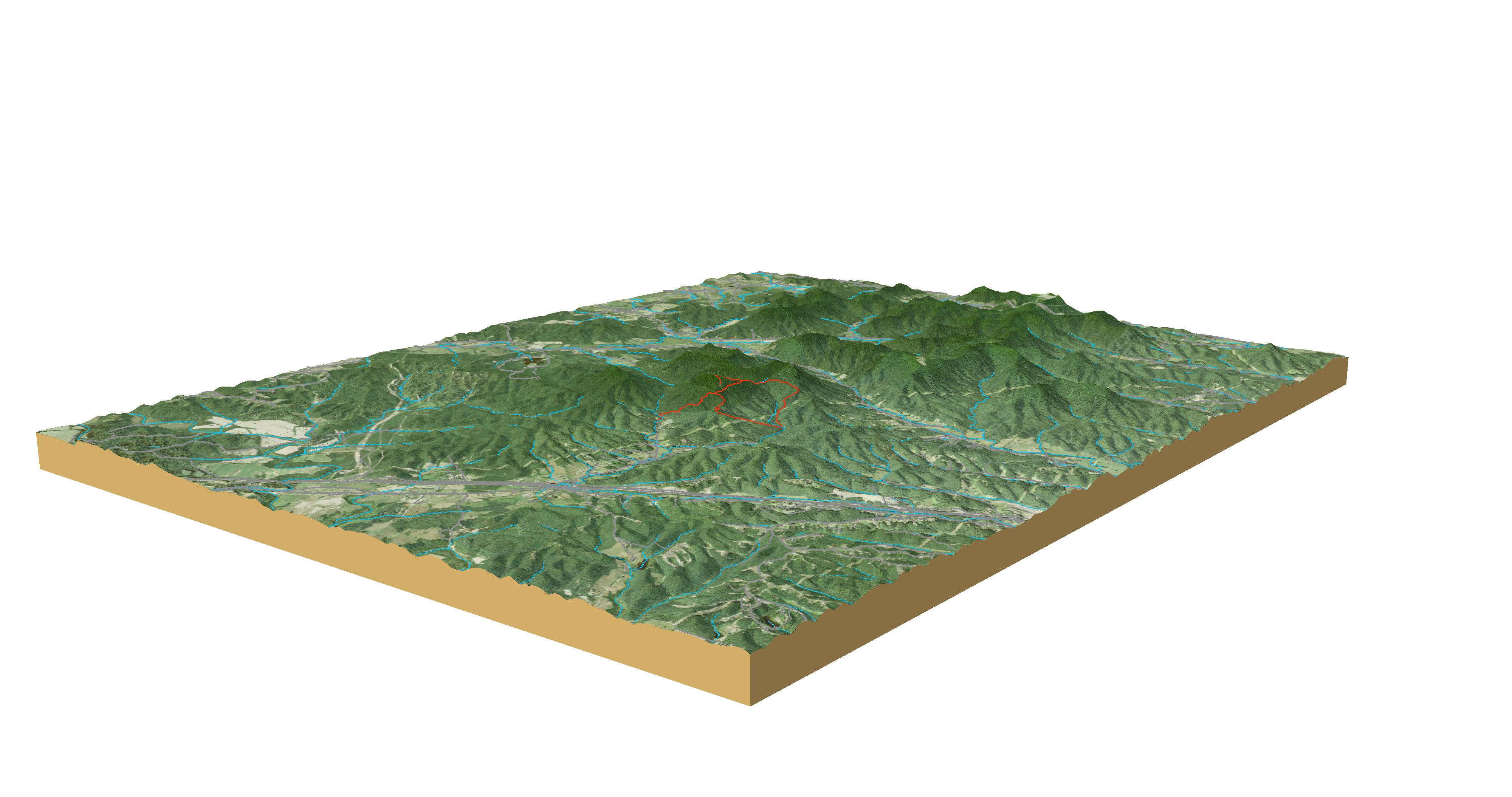
A rendered animation of the Pilot Knob area
Interactive Map of Pilot Knob SNP
Created on Carto.com
Mapping Project Information

Photo Credit: Boyd Shearer

Photo Credit: Boyd Shearer
I visited the nature preserve on September 21, 2016 and used my cell phone to collect GPS data for the existing trails. I mapped approximately 3.2 miles of trail and used ArcGIS to create a 2D map and 3D map of the nature preserve.


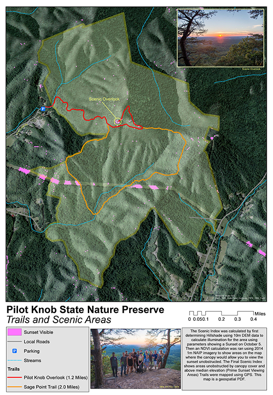
Geospatial PDF showing scenic index and hiking trails
The Scenic Index was calculated by first determining Hillshade using 10m DEM data to calculate illumination for the area using parameters showing a Sunset on October 5. Then an NDVI calculation was ran using 2014 1m NAIP imagery to show areas on the map where the canopy would allow you to view the sunset unobstructed. The Final Scenic Index shows areas unobstructed by canopy cover and above median elevation (Prime Sunset Viewing Areas) Trails were mapped using GPS. This map is a geospatial PDF.
Page created by Nathaniel Vogler, November 21, 2016, for NRE 355, an introduction to GIS analysis at the University of Kentucky CAFE Natural Resources and Environmental Sciences program.