3D Views of Pilot Knob State Nature Preserve

A distant view of the Pilot Knob SNP area

A view of the Pilot Knob SNP Overlook Trail
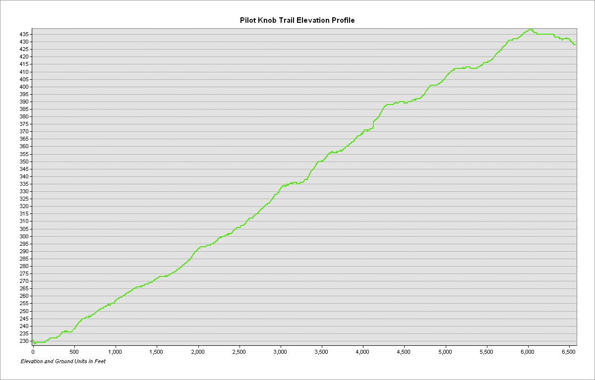
Elevation profile of the Overlook Trail
Trail statistics: The Overlook Trail is .629 miles in length with an average slope of approximately 9.44°. The highest slope is 36.82°.
A rendered animation of the Pilot Knob area
CARTO interactive map of trail network
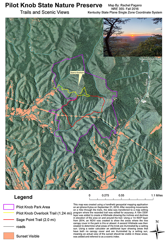
Mapping Project Information:
This page and all attached maps were created by Rachel Pagano and assembled November 21,2016 as a submission for NRE355 at the University of Kentucky, an introductory course to GIS and mapping. On September 21, 2016 students in the class visited Pilot Knob State Nature Preserve and, using mobile devices with GPS capability, tracked their movements as they followed the existing trails at the nature reserve. Once the trail data had been collected, students used ArcMap, ArcScene, and CARTO to create 2D and 3D maps of the area as well as caluculated relevant information about the trails such as elevation and trail length.


Photograph Credit: Boyd Shearer